Sun Yat-sen University
Bachelor’s · Geographic Information Science
 ChinchillaCHINCHILLA
CHINCHILLA / PERSONAL BLOG
Remote sensing · Geospatial data analysis
Bachelor’s · Geographic Information Science
Master’s · Geospatial Data Science
Laboratory for National Development and Intelligent Governance
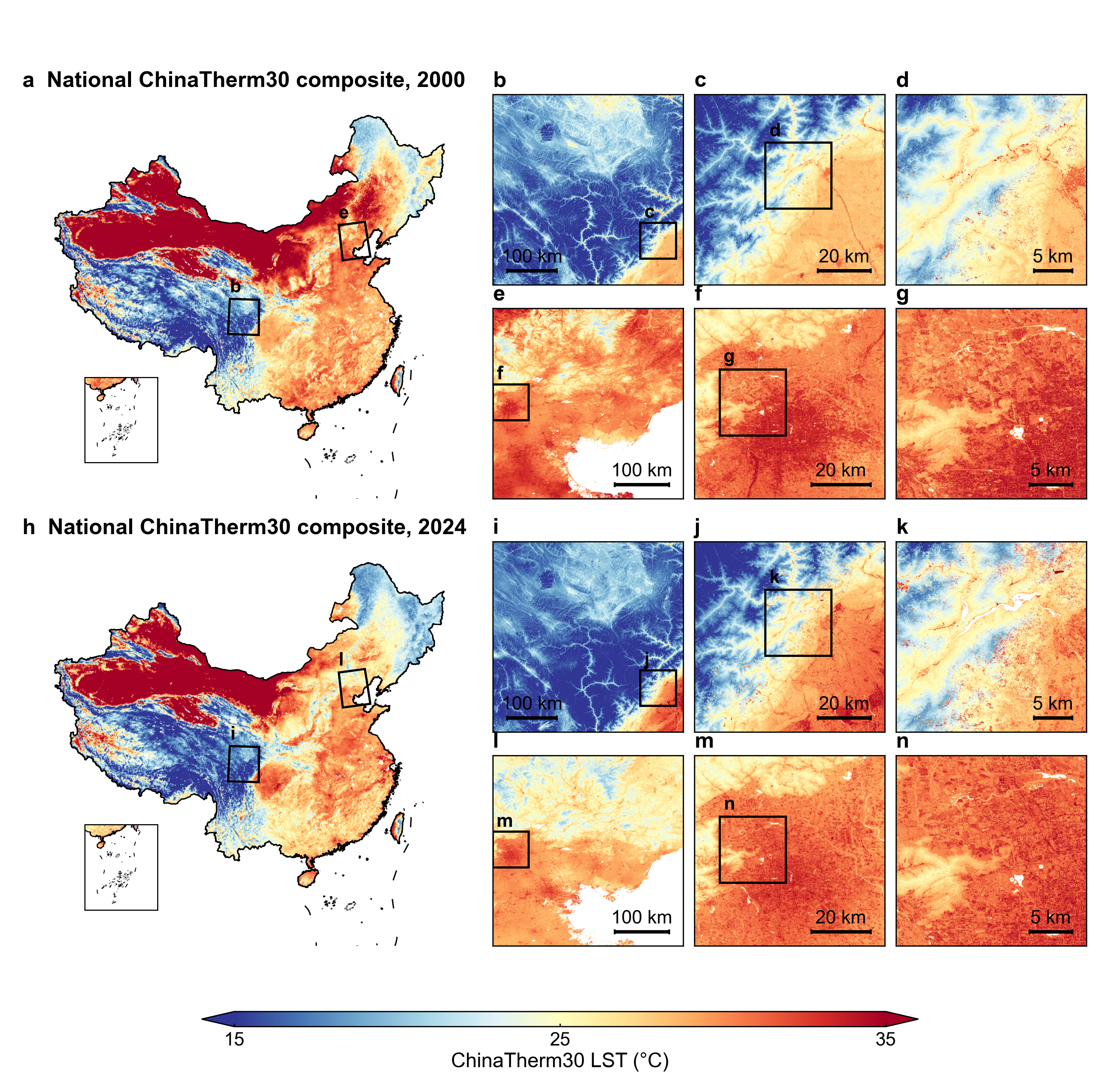
A 30 m land surface temperature dataset for China
Annual 30 m leaf-on daytime land surface temperature composites across China, covering 2000–2024. The data are publicly available for download and exploration on an interactive map.
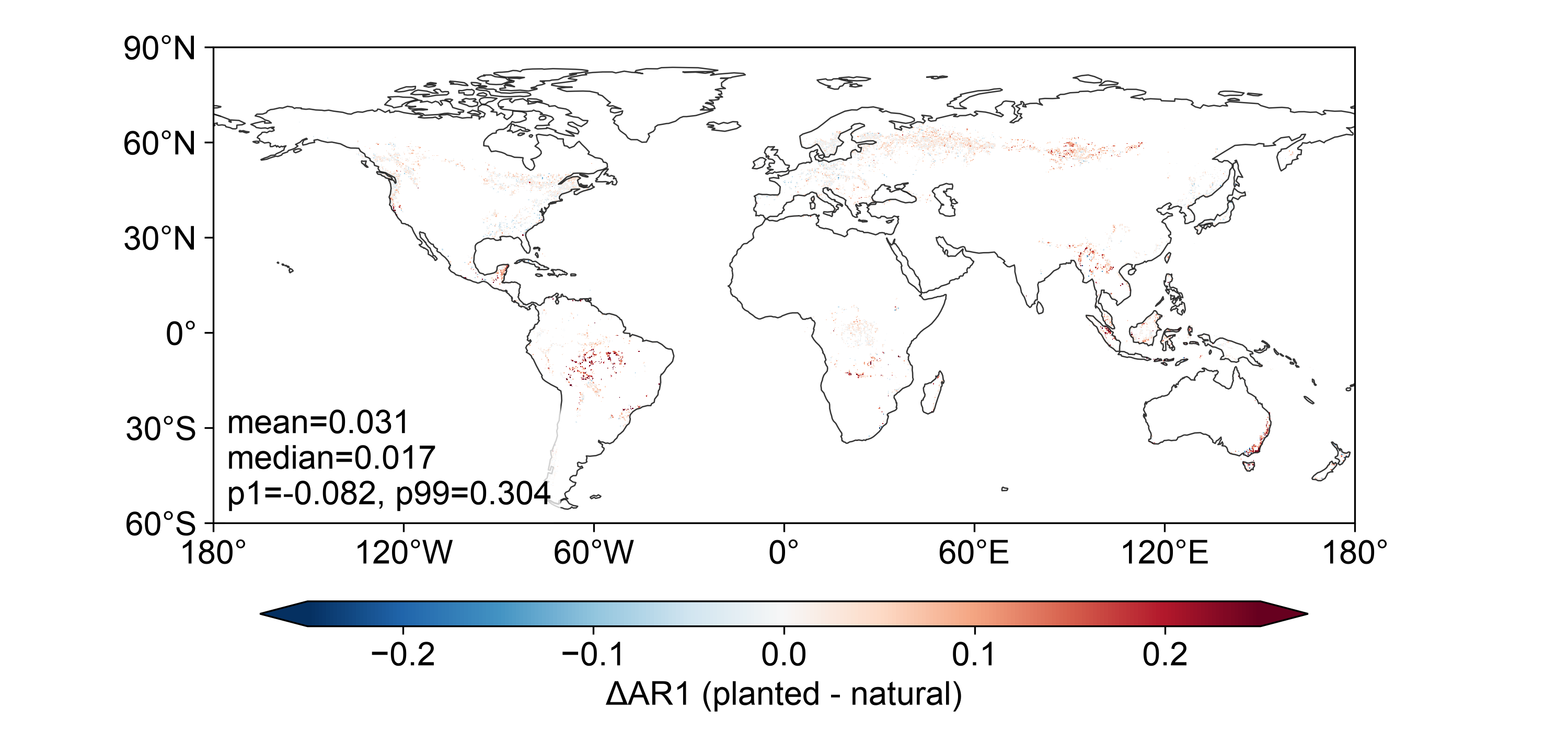
Global Comparison of Natural and Planted Forest Engineering Resilience from MODIS Time Series
Using MODIS vegetation-index time series and first-order autocorrelation (AR1) of detrended and deseasonalized residuals to compare engineering resilience and its spatial variation in natural and planted forests.
Retrieval of forest aboveground biomass in Guangdong Province from 2017 to 2024 based on multi-source remote sensing data
Combining GEDI, Sentinel-1 and Sentinel-2 observations with XGBoost to estimate forest aboveground biomass in Guangdong and analyze its spatial patterns and changes from 2017 to 2024.
Read the thesis and overviewEnvironmental data visualization
A course project for visualizing and exploring environmental data with WebGIS.
Open EcoEnvAtlas